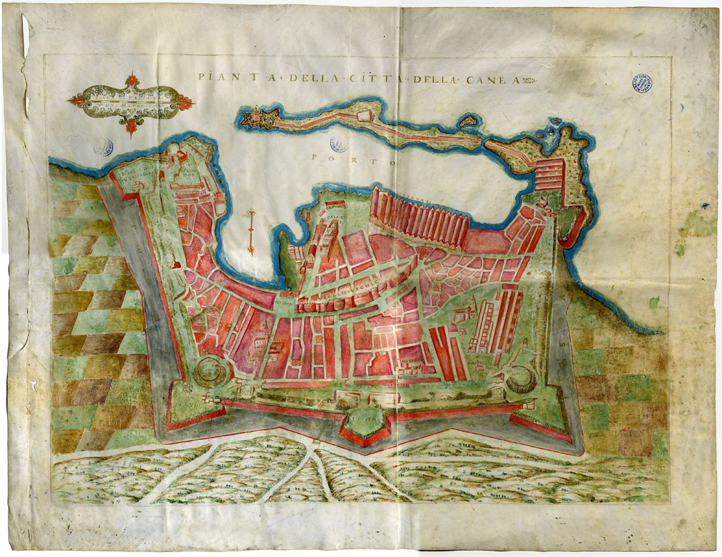
 Map of the city of Canea (Chania) on Crete. 16th century, ink and watercolor drawing on parchment.
Deutscher Text am Ende
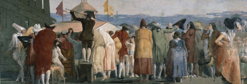
This small exhibition curated by the director of the Doge’s Palace, Camillo Tonini, and by Diana Cristante, offers the extraordinary privilege to see original drawings on parchment and on paper made between the 16th and the 18th century of Venetian fortresses in the Mediterranean area.
Venice, besides being an extraordinarily wealthy and glamorous city, was also political and military power. The preservation of important outposts in the Mediterranean sea secured the routes of commercial convoys heading toward Alexandria in Egypt, to Constantinople, Cyprus, Haifa, and many other destinations.
Gradually Venice enlarged its possessions in the Aegean and Ionian sea; still today the time of the Venetian ruling is called in Greek Venetokratia.
The officers sent by the Republic to administrate these territories, the provveditori, were also in charge of their military defense. If in the 14th century Venice fought above all against Genoa, from the 15th century onward immense monetary and human resources were sacrificed in the wars against the Ottomans.
Because of this constant state of war and the development of new weapons, Venice steadily modernized and improved its fortresses in the Mediterranean. The provveditori would send exact drawings and maps of their territories to Venice where all decisions about the necessary interventions were taken.
The maps on display are stunning for the precision of the areas they reproduce but also because they show the landscape. Until the 18th century it was not common to make pure technical drawings, they were always embellished, especially by the use of color, which is what makes this exhibition so enjoyable also by non-experts.
Among the most interesting maps there is the siege of Candia in 1668 (Iraklion today) by the Turks, where you see the Ottoman military camp surrounding the city.
Another one shows the project of a canal cutting the isthmus of Corinth, to create a shortcut for the ships.
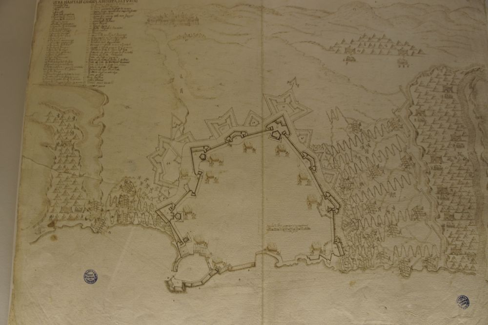 The fortress of Candia (Iraklion) surrounded by the military camps of the Ottomans. 1668. Ink drawing on paper.
Following the reconquest of the Peloponnese (Morea,1684-99) by Francesco Morosini, the last great Captain-General (who later became Doge), there was a period of hope in a new expansion towards the East. Vincenzo Coronelli, a Franciscan monk and a famous cartographer, published a volume with the maps of the Venetian fortresses, which is also on display.
Later in the 18th century, the German General Matthias von der Schulenburg, a soldier and an art-lover who bought many paintings by Guardi, was put in charge of the defense of all sea possessions of the Republic. He strengthened above all Corfu in the Ionian sea and Zara (Zadar) on the Dalmatian coast.
Today these names – Corfu, Dalmatian cost, Crete – are rather associated with vacation paradises. In the past they contended commercial and military basis; they were territories where the Republic experimented with new concepts of fortification. These maps are today also a way to help the local archeologists and historians to investigate their past.
If you visit the Doge’s Palace you can’t miss this exhibition. For a while your eyes will lower from the golden ceilings and from the paintings in order to look at those meticulous signs made with ink, those green and blue landscapes made with watercolors surrounding the fortresses that would protect them.
It’s a small history of unknown people, cartographers who dedicated themselves to their duty well aware that from their precision depended on the security of the place; but into those maps, no matter if only for esthetic reasons, they brought a much larger world.
Palazzo Ducale
8 marzo – 22 settembre 2013
Sala dello Scrutinio
(admission included in the ticket of the Doge’s Palace).
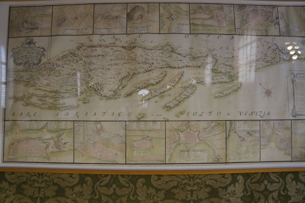 When the Adriatic Sea was called Gulf of Venice. The provinces of Dalmatian and the Venetian Albania.
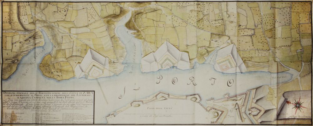
The fortifications of Zara (today Zadar), 1764, color drawing on paper.

Map and fortresses of Corfu in 18th century. Ink and watercolor drawing.
Deutscher Text
Venedig war eine politische und militärische Macht. Die Erhaltung wichtiger Außenposten im Mittelmeer sicherte die Routen der Handelskonvois in Richtung Alexandria in Ägypten, nach Konstantinopel, Zypern, Haifa und vielen anderen Zielen.
Aufgrund des ständigen Kriegszustands und der Entwicklung neuer Waffen modernisierte und verbesserte Venedig seine Festungen im Mittelmeerraum stetig. Die Provveditori (Offiziere die für die Verteidung im Mittelmeer zuständeig waren) schickten genaue Zeichnungen und Karten ihres Territoriums nach Venedig, wo alle Entscheidungen über die notwendigen Interventionen getroffen wurden.
Heute sind die Namen Korfu, Dalmatien, Kreta eher mit Urlaubsparadiesen verbunden. In der Vergangenheit waren sie Gebiete, in denen die Republik mit neuen Konzepten der Befestigung experimentierte. Diese Karten sind heute auch eine Möglichkeit, den örtlichen Archäologen und Historikern zu helfen, ihre Vergangenheit zu untersuchen.
